rest of the season. There is an area of low pressure brewing on the tail end of the decaying front
over the western Caribbean. The shearing environment if favorable for development and a look
at the MIMIC Satellite Derived Tropical Precipitable Water products from CIMSS we find
ample moisture.
http://tropic.ssec.wisc.edu/real-time/mimic-tpw/natl/main.html
The low is still disorganized but the conditions are getting better. A look at the Infrared imagery
shows the suspect area.
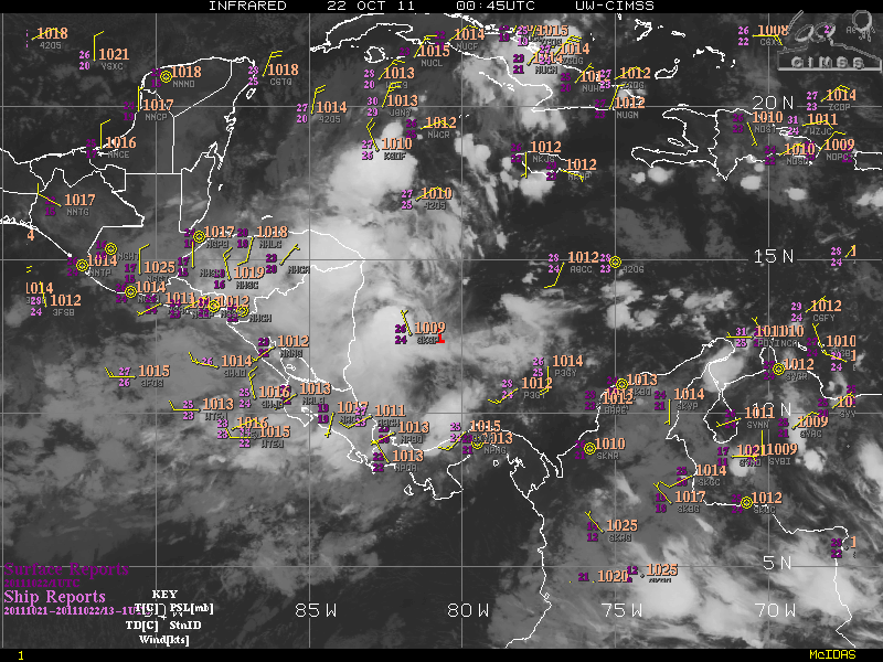
Pressure is falling across this area and from the surface observations plotted on the image above
we see a large circulation forming.
The 5 day Hovmoller diagram show the evolution thus far and how this is a persistent pattern
remaining nearly stationary between the Panama Bite and eastern tip of Nicaragua.

As for what this will become? The global models are in good agreement for the early stage of the
storm life cycle, and similar there after. The latest GFS prognosis is to bring the storm north across
the western tip of Cuba, then drive it east through the Florida Straits. The ECMWF has the system
in the same place off western Cuba but then differs by taking it north across the Sarasota/Tampa
area, continuing off the Daytona to Jacksonville coast. The Canadian (CMC) takes the storm to
the western tip of Cuba before the run ends. All of these are similar through 132 to 144 hours.
That all the models are developing a storm is the issue. Normally I would be stating the fact that
there is yet to be a circulation initialized for the models to bite onto. However, when all of them
starts a storm it is a good bet there will be one. So we will wait to see what we get when the initial
circulation is plugged into the existing solution. I expect that my trip to Tallahassee for the NC State
game will be nixed due to demands of operations here. I will keep the blog updated but these may
be brief if we get into watches and warnings.
The current intensity output shows a possibility for a category 3 to 4 storm and it would be named
Rina.
Expect if the storm develops hurricane operations will begin as early as Tuesday night for the Keys.
No comments:
Post a Comment